
The Four Historic Communities
The Community Advisory Group
The Community Advisory Group and Heritage and Conservation Group are volunteer-led groups made up of local residents, historians and stakeholders who have played a key role in shaping the project. The Community Advisory Group provides local insight, helping guide activities, events and future plans to ensure they reflect community priorities, while the Heritage and Conservation Group focuses on identifying, researching and validating heritage assets and stories. Together, they ensure the project is rooted in local knowledge, supports community ownership and builds a strong foundation for long-term, community-led heritage development.
Trevor
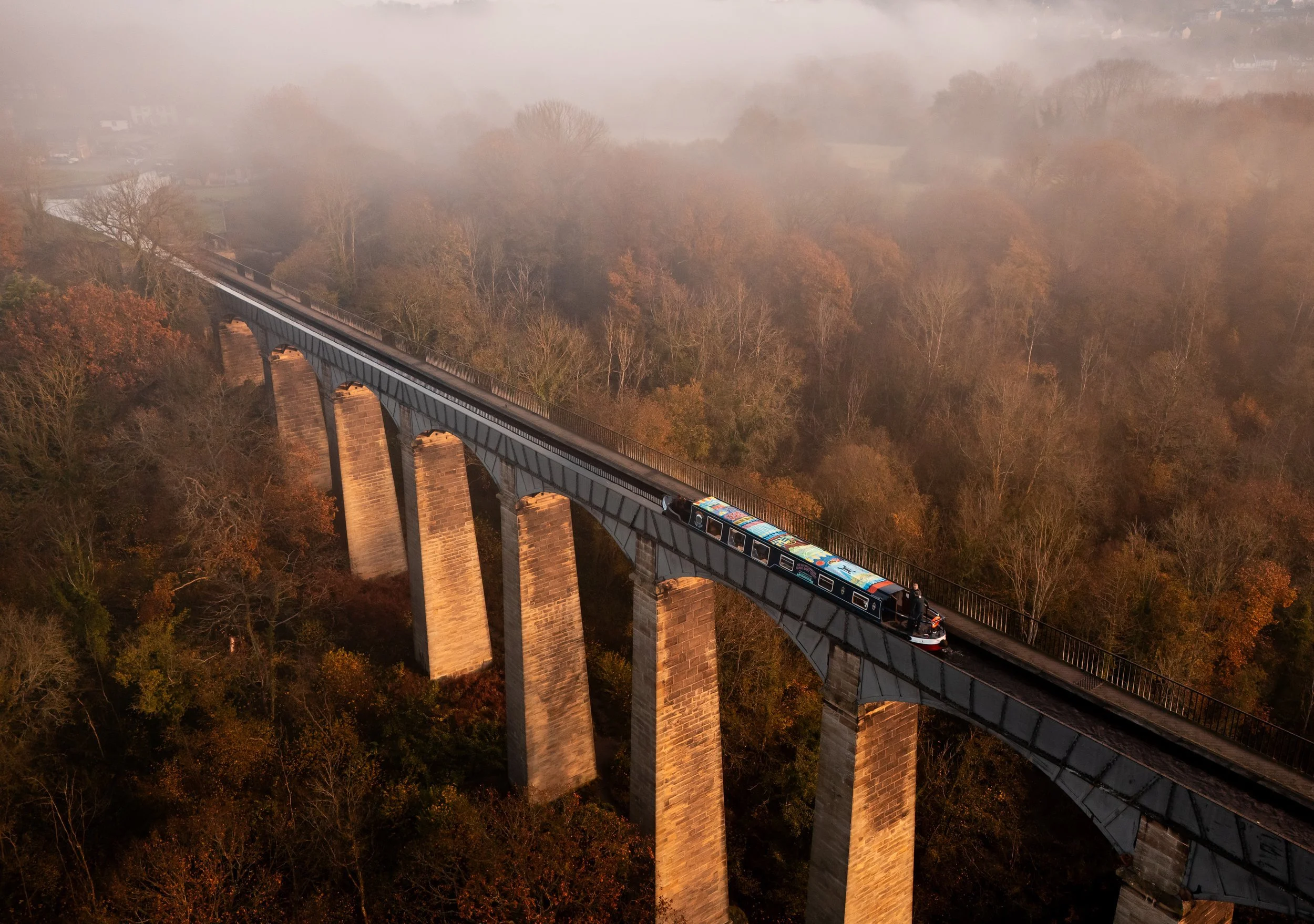
"Trevor holds a unique place within the Pontcysyllte Aqueduct and Canal World Heritage Site as a historic meeting point of engineering, industry, and everyday community life. Developed in direct response to the construction of the aqueduct and canal, Trevor grew as a working settlement shaped by boat building, cargo handling, rail connections, and the movement of people and materials. Its basin was once a lively industrial hub, where labour, skill, and social life converged, creating a strong working-class culture rooted in shared effort and mutual reliance. The physical landscape of Trevor - the basin, towpaths, bridges, and surrounding buildings reflects this layered history and remains central to the identity of the village today." "Culturally, Trevor has long been a place of connection and exchange. Beyond its industrial function, it was shaped by the social rituals, stories, and creative expression of the people who lived and worked there. Chapels, pubs, sports, and informal gathering spaces played a vital role in sustaining community life alongside demanding industrial labour. Today, Trevor continues to hold cultural significance as a gateway to the wider World Heritage Site and as a focal point for heritage-led creativity, storytelling, and community activity. Its past and present are deeply intertwined, offering powerful opportunities to explore how culture, labour, and landscape combine to shape a living sense of place."
Froncysyllte
Colloquially known as Fron, meaning “hillside” or “slope”, Froncysyllte occupies a distinctive position within the World Heritage landscape. Set on the banks of the River Dee and the Llangollen Canal at the southern end of the UNESCO-listed Pontcysyllte Aqueduct, the village was built on a high outcrop of limestone beneath surrounding quarries. Its location, form, and name are inseparable from the land itself, reflecting a settlement shaped by geology, elevation, and proximity to industrial resources rather than transport alone. Today, Fron remains home to a thriving community centre, continuing its long tradition as a place of social gathering and local organisation.
Although Froncysyllte’s traditional industries have now gone, its cultural significance lies in the visibility of its industrial past within the landscape. Hidden tramways, lime kilns, industrial architecture, monuments, bridges, and historic walks remain embedded in and around the village, forming a rich and layered industrial archaeology. This visible heritage tells the story of production, labour, and skilled work that once defined everyday life in Fron, and of a community shaped by extraction, making, and resilience. Together, these elements give Froncysyllte a unique identity within the World Heritage Site, one rooted in land, material, and lived experience, rather than monumental engineering alone.
Chirk
Chirk is a historic border town with deep roots stretching back to the 11th century, where layers of medieval, industrial, and contemporary life coexist within a thriving local community. Its architectural heritage remains clearly visible across the town, from medieval remnants to later industrial infrastructure, including the striking Chirk Aqueduct and Viaduct. Anchored by an active high street and framed by landmarks such as Chirk Castle, the town occupies a unique position where Welsh and English histories meet, shaping its character, identity, and sense of place.
Beyond the town centre, Chirk’s landscape opens out to Brynkinalt Park, where mining artefacts, woodland paths, and expansive views toward the Berwyn Hills and across the border into Shropshire reveal the area’s industrial and natural heritage side by side. The social histories of the town’s people, known locally as “Chirkers” have been carefully preserved through artefacts, memorabilia, photography, and oral histories by historians, community figures, and artists. Together, these collections tell a rich story of working life, community resilience, and cultural continuity, making Chirk a vital part of the wider World Heritage narrative.
Cefn Mawr
Cefn Mawr is a village of remarkable historical depth, often described as a topographical hidden gem within the wider World Heritage landscape. Set within the UNESCO World Heritage Site buffer zone, its village centre reveals an extraordinary concentration of architectural heritage, shaped by a labyrinth of pathways and routes created to serve the diverse industries that once operated here. Built into the hillside, Cefn Mawr’s form reflects the intense relationship between place, labour, and landscape, resulting in a settlement unlike any other in the valley.
For over a century, Cefn Mawr’s skyline glowed with the orange and red light of blast furnaces serving ironworks and brickworks, marking it as a powerhouse of heavy industry. Alongside these were clay works, coal mines, chemical plants, and stone quarries — industries that left traces still visible today, sometimes in villagers’ own back gardens. Many regard Cefn Mawr as the catalyst or birthplace of the valley’s industrial development, made possible by its exceptional mineral wealth. Although often overlooked by visitors to the World Heritage Site, Cefn Mawr holds profound historical significance, offering vital insight into the industrial forces, skilled labour, and community life that shaped the wider landscape and helped drive industrial progress far beyond the region.